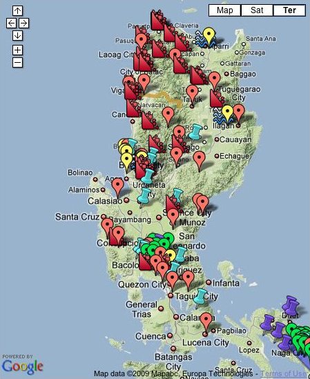
Cool Interactive Mapping of the Philippines current typhoon called Pepeng. It's powered by Google, modified by the
GMA Philippines News Network with the help of volunteers from the UK. This is cool. Not too long ago, before the Typhoon Ketsana hits Philippines, I was just checking out the Philippines Google Map specially the region where I was born and grew up till the age of 12. I wish they had navigators that mapped out the roads on the ground, like the ones they have for US regions, except for Hawaii. The US Google Map navigator has a little man icon where you place him on the road, and it will show 360 degree angle of the road's surroundings, showing actual photo images. I was trippen the first time I checked it, because it can actually show my front house. Philippines doesn't have that yet, but it was cool enough to see the roof top of my house from there. I was so fucking stoked man, I can actually see the elementary schools I went too, the trees where I used to take fruits from, my childhood friend's houses, the
paoay church where my ancestors built, bakeries, the creek I never knew that trails all the way to the ocean, the place where I flight kites at, and so on.
I'm sure there are lots of stabbings going on too. In the other hand, I really admire their spirits man...
Anyway, check out this map or click on it for some interactive updates:


No comments:
Post a Comment